In recent decades, large-scale environmental destruction has become one of the most pressing concerns of the global community. Industrial activities, excessive exploitation of natural resources, widespread deforestation, and major environmental pollution have caused serious damage to natural ecosystems. In this context, the concept of “ecocide” has emerged as one of the most severe forms of environmental destruction. Ecocide generally refers to widespread, severe, or long-term damage to the environment that results in serious consequences for ecosystems and for human and non-human life. Given the complexity and scale of such destruction, proving the occurrence of ecocide in legal and international forums is not a simple task. In recent years, advances in technologies such as artificial intelligence and satellite data have made it possible to provide more accurate and reliable evidence for investigating and proving such crimes.
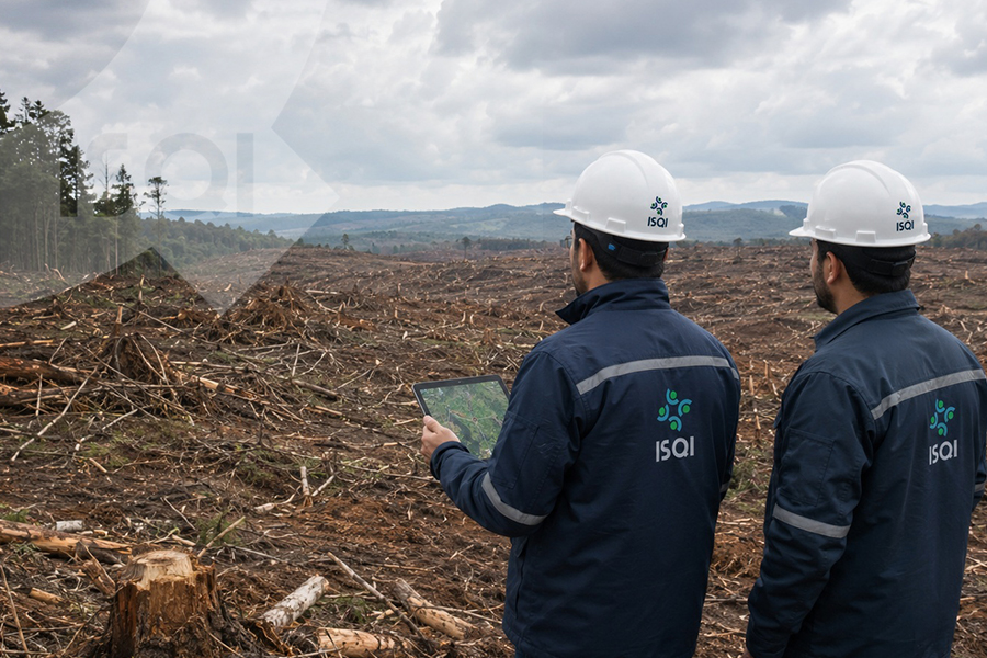
Satellite data are considered one of the most important modern tools for environmental monitoring. Earth observation satellites can capture extensive images and data from the Earth’s surface over different time periods. These data make it possible to analyze environmental changes on large geographic scales. For example, satellite imagery can show the trend of deforestation in a region over several years, record changes in the water levels of lakes and rivers, or reveal the effects of oil spills and industrial pollution. One of the major advantages of satellite data is that they are typically collected continuously and at regular intervals, making it possible to compare the condition of a specific area across different time periods.
Despite their high value, the enormous volume of satellite data makes manual analysis difficult. This is where artificial intelligence plays a crucial role. Machine learning and deep learning algorithms can analyze vast quantities of satellite images in a short time and identify specific patterns that indicate environmental destruction. For instance, AI-based systems can detect changes in vegetation cover, identify areas affected by deforestation, or recognize signs of pollution in water resources. These analyses can be performed automatically, thereby increasing both the speed and accuracy of environmental monitoring.
One of the most important applications of combining artificial intelligence and satellite data in the context of ecocide is the precise documentation of environmental changes. In legal cases, the existence of reliable and accurate evidence is essential. Satellite images can demonstrate the condition of a region before an industrial or extractive activity took place and how it changed afterward. Artificial intelligence can also measure and analyze the extent of destruction and even determine the timeline of that damage. Such information can serve as scientific evidence in environmental investigations or court proceedings.
Another important application of these technologies is identifying the source of environmental destruction. One of the key challenges in proving ecocide is determining whether the damage resulted from natural causes or from human activities. For example, a reduction in vegetation cover may be caused by natural drought or by deliberate deforestation. AI algorithms, using various types of data such as climatic information, geological data, and satellite imagery, can analyze patterns of destruction and assess the likelihood of human involvement. This can play a significant role in establishing legal responsibility.
Furthermore, satellite data enable long-term environmental monitoring. In many definitions of ecocide, the scale and persistence of environmental harm are important criteria. By using satellite images recorded over extended periods, it is possible to demonstrate how widespread an environmental damage has been and whether its effects have continued over time. Artificial intelligence can analyze these temporal datasets to identify long-term trends and measure the intensity of changes.
Despite these advantages, the use of artificial intelligence and satellite data in proving ecocide also faces challenges. One such challenge concerns the accuracy and interpretation of data. Satellite images may be affected by factors such as cloud cover or limitations in image resolution. AI-based analyses may also require extensive and high-quality training data. Moreover, for such data to be used in courts, clear standards for scientific and technical validation must exist. In many legal systems, comprehensive frameworks for admitting this type of evidence are still under development.
Nevertheless, technological progress indicates that the role of artificial intelligence and satellite data in environmental monitoring and protection is steadily increasing. Many international organizations, governments, and research institutions use these technologies to monitor deforestation, water pollution, habitat destruction, and other environmental threats. These tools can enhance transparency regarding harmful activities and strengthen legal accountability.
In conclusion, artificial intelligence and satellite data have significant potential to assist in identifying and proving possible cases of ecocide. By providing precise, comparable, and scientifically grounded evidence, these technologies can strengthen the process of documenting environmental destruction and support researchers, regulatory bodies, and judicial authorities in examining such cases. Although legal and technical challenges remain, continuous technological advancement is likely to further enhance the role of these tools in proving environmental crimes in the future.
Author: Zahra Shirband – International Relations Expert ISQI
Sources:
- Higgins, P. (2021). Ecocide and the Law: Protecting the Planet. Shepheard-Walwyn.
- United Nations Environment Programme (UNEP). Artificial Intelligence and Environmental Monitoring Reports.
- European Space Agency (ESA). Earth Observation and Environmental Monitoring Publications.
- NASA Earth Science Division. Satellite Data for Environmental Change Detection.
- World Resources Institute (WRI). Global Forest Watch Methodology and Satellite Monitoring Reports.
- OECD (2024). Artificial Intelligence for Environmental Sustainability.